To start the new year with an easy local tramp with a difference I search our suggested trip list. As a civil engineer with a passion for water engineering, walking the Maitai raw water pipeline seemed a good idea, both teaching and walking.
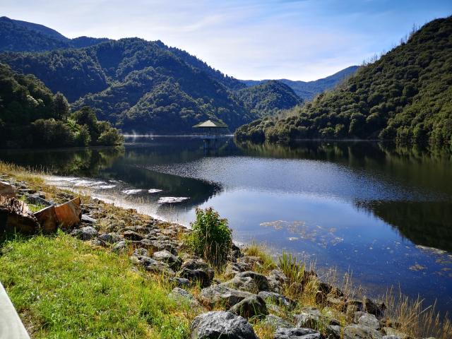
The day was dry and mild after yet another wet Saturday. We started at the Maitai dam, where I explained about the newly installed aeration system visible across the main body of the dam. Its purpose is to improve the water quality of the dam water by ensuring sufficent disolved oxygen through the full depth of the water column. See information about the construction here: https://shape.nelson.govt.nz/maitai-dam-aeration/project-complete
 New aeration system in action - note the spray created by the bursting air bubbles
The water flowing over the spillway was art in motion, forming ever changing wave patterns as it travelled down the spillway slope.
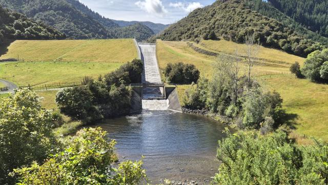 Dam spillway
Our next stop was to the raw water intake on the Maitai South branch. Here a little weir acts as a capture point for the water we drink in Nelson – Stoke, below which the equivalent volume of dam water is released into the Maitai dam.
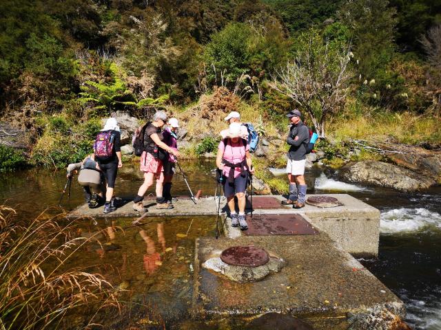 Inspecting the raw water intake from the Maitai South branch River
Then it was over the new concrete bridge and onto the Coppermine cycle trail to follow the old raw water pipeline down to the Tantragee water treatment works. The trail was an easy grade and we marvelled at the construction of this 900 mm diameter concrete pipeline completed in 1987. However, the water loss through cracking was clearly visible supporting the numerous plants growing on and around the pipeline.
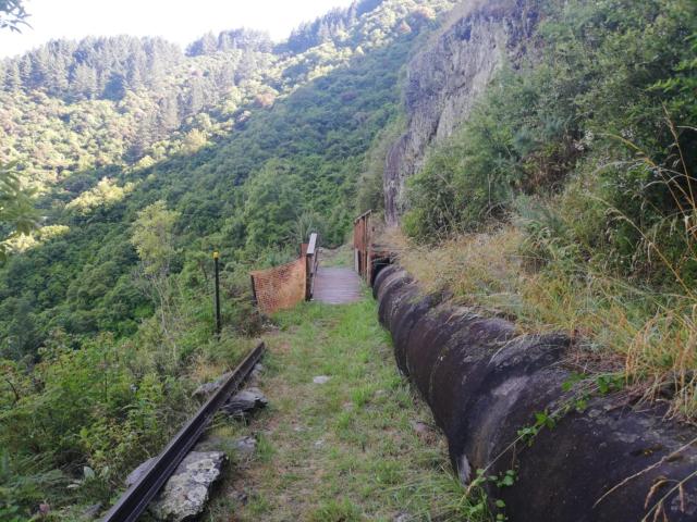 The pipeline with its cloak of vegetation
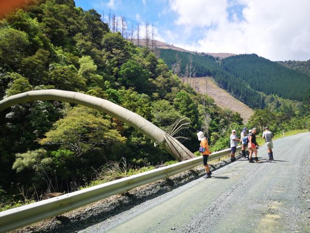
We crossed the new pipeline bridge constructed following the devastating flooding of August 2022, when a section of the pipeline was washed away. You can see how they repaired the pipeline in the link: https://www.youtube.com/watch?v=9FSkSba6QC8
The pipeline passed through some pine plantations where Debbie picked young slippery jack boletus mushrooms for dinner. We parted company from the pipeline when it dropped sharply down the hillside and crossed the Maitai River to rise steeply up the other river bank again, through an inverted syphon. We continued along the Coppermine trail until it joined the Maitai River road near the Smith Ford bridge and walked back up the road to view the pipeline crossing.
 Inspecting the first pipeline river crossing
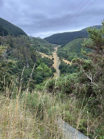
The pipeline crosses Māori land in the next section, but NCC has a pipeline easement which we followed (permission needed from NCC). An easy 2.5 km walk, high above the Maitai River valley brought us to the spot where the pipeline dropped steeply back down to cross the Maitai river again before rising more slowly through the Maitai Aboretum to the water settling ponds and through a tunnel under Tantragee saddle to the treatment works. It’s amazing to realize this pipeline is only gravity fed.
 Following the pipeline high above the Maitai River bed
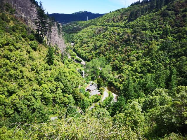
 Maitai pipeline dropped to cross the river again and back up the other bank to the treatment works. The pipeline is visible in the left of the picture as a horizontal route almost as high as we currently were.
We enjoyed a brief lunch at our high vantage point, then headed down to the Maitai River road again. The only access point down from here is through private property owned by the Maitai Whare Iti – Nelson adventure cabins. The cute cabins are a great asset for visitors looking for get away accommodation in a rural setting near Nelson. The property owner was very welcoming and had kindly gave us permission to walk down trhough his land to the road.
We said goodbye to the Maitai raw water pipeline at the second pipeline bridge where our cars were parked, electing to continue our walk up to the treatment works on another day. Track length 10.4km, vertical climb 212m and vertical descent 289m.
Participants: Debbie (leader & scribe), Graeme, Sally, Maaike, Esther, Eric, Jane and Tony.